Book Image

QGIS Quick Start Guide

By : Andrew Cutts
Book Image

QGIS Quick Start Guide

By: Andrew Cutts

Overview of this book

QGIS is a user friendly, open source geographic information system (GIS). The popularity of open source GIS and QGIS, in particular, has been growing rapidly over the last few years. This book is designed to help beginners learn about all the tools required to use QGIS 3.4. This book will provide you with clear, step-by-step instructions to help you apply your GIS knowledge to QGIS. You begin with an overview of QGIS 3.4 and its installation. You will learn how to load existing spatial data and create vector data from scratch. You will then be creating styles and labels for maps. The final two chapters demonstrate the Processing toolbox and include a brief investigation on how to extend QGIS. Throughout this book, we will be using the GeoPackage format, and we will also discuss how QGIS can support many different types of data. Finally, you will learn where to get help and how to become engaged with the GIS community.
Table of Contents (9 chapters)

Model builder

You may recall that in the Chapter 6, Spatial Processing we ran several tools to utilize the zonal histogram answer to the distribution of terrains (Landcover) in a buffered pipeline corridor. Open a new QGIS project and load in the Pipeline layer and the Landcover.

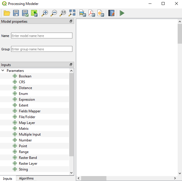
To create a model, go to Processing | Graphical Modeler to open the modeler, where we can select from different Inputs and Algorithms for our model. Graphical Modeler is shown in the following screenshot:

The Graphical Modeler

Select the Inputs tab and choose Vector Layer. Add a new parameter called Pipeline and set Geometry type to Line; this is shown in the following screenshot:

Creating a Pipeline attribute as a Geometry type—Line

Click on OK. Now, add Raster Layer and call it Landcover. In the Algorithms tab, we can use the filter at the top to narrow down our search for the correct algorithm...