
We have a new model, so we need to create a new geodatabase. Let's keep our existing Bestaurants geodatabase and call the new one Bestaurants_new.
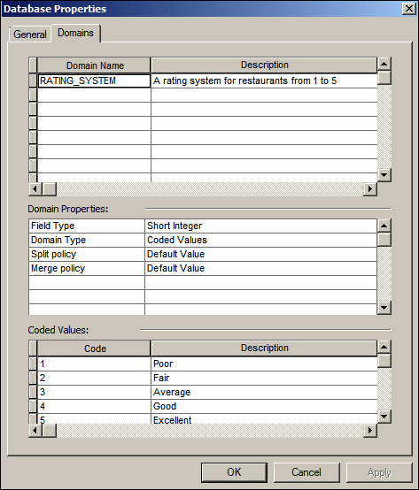
To create the geodatabase, open ArcCatalog, browse to c:\gdb, and create a Bestaurants_new file geodatabase (refer to Chapter 1, Authoring Geodatabases, in case you have forgot how to do this). We need to create the RATING_SYSTEM domain. Right-click on the new geodatabase and select Properties, and then activate the Domain tab. We have done this previously in Chapter 2, Working with Geodatabase Datasets. The following screenshot will remind you how to create the domain: