

ArcGIS Pro has three different license levels: Basic, Standard, and Advanced. The license level determines the level of functionality available to the user. Basic has the least functionality, Advanced has the most, and Standard is somewhere in between.
In general, Basic allows you to visualize GIS data, produce maps, perform simple data edits, and perform basic GIS data analysis. Standard builds on the capabilities of the Basic level, with more advanced editing and data validation tools. Advanced expands the capabilities of both Basic and Standard by adding more data analysis tools. For a complete list of the capabilities of each license level of ArcGIS Pro, go to http://pro.arcgis.com/en/pro-app/get-started/license-levels.htm.
It important for you to know what license level you are using so you know what capabilities are available to you. Some recipes in this book will require a Standard or Advanced license. In this recipe, you will learn how you can determine your ArcGIS Pro license level.
You will need to make sure that you have successfully installed ArcGIS Pro 2.0 or higher. If you have not installed ArcGIS Pro yet, please refer to http://pro.arcgis.com/en/pro-app/get-started/install-and-sign-in-to-arcgis-pro.htm for installation instructions.
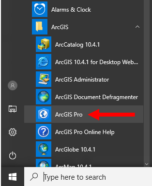
- Go to the Windows Start button, which is normally located in the lower-left corner of your screen.
- Scroll down to the
ArcGISprogram group and clickArcGIS Pro:
Note
Depending on the version of Windows you are running, your Windows Start button and display might be a bit different. You may also need to click All Programs to see the ArcGIS program group. If you right click the ArcGIS Pro icon you can select to add it to your task bar at the bottom of your display. This makes starting ArcGIS Pro faster and easier.
- The ArcGIS Pro start window will appear. Click
About ArcGIS Pro, located in the lower-left corner of the start window. - In the
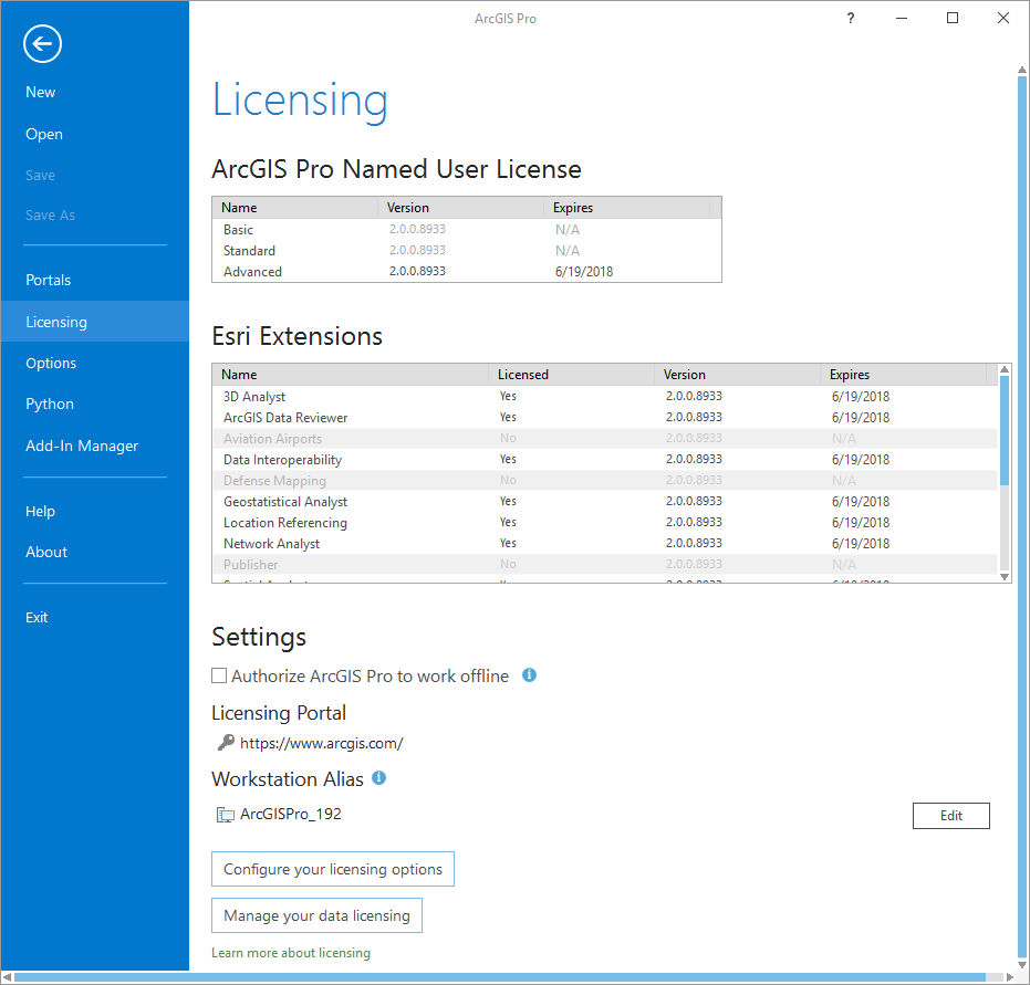
About ArcGIS Prowindow, selectLicensing, located in the left side of the window. This will display your ArcGIS Pro licensing information:
Note
If you already have an ArcGIS Pro project open, you can access this same information from the project pane.
At the top of the Licensing window, you will see what license level you have been assigned. As you can see in the image, I have access to the Advanced license level. From here, you can also see which extensions you have access to. Extensions are add-ons for ArcGIS Pro, which provide additional functionality and are normally focused on a specific use, such as 3D analysis or network analysis. Again, in the image, you can see I have access to several extensions:
Note
Question: What license level have you been assigned, Basic, Standard or Advanced?
Answer:
Question: Do you have access to any extensions, and if so which ones?
Answer:
- Once you have determined the license level you have access to, you can close ArcGIS Pro if you are not continuing to the next recipe. If you are continuing, keep ArcGIS Pro open.
In this recipe, you learned how to determine which license level of ArcGIS Pro you had access to. You did this by going to the About ArcGIS Pro window from the ArcGIS Pro start window. From there, you accessed your license level information by clicking the Licensing option located on the left side.
The license level is important, as it determines what functionality you have access to within the program. As you will see in this book, some recipes will require you to have access to higher license levels.
The Licensing window allows you to do more than just see what license level and extensions have been assigned to you. It also allows you to determine what type of ArcGIS Pro licensing you want to use, check out a license for use in the field, and more.
ArcGIS Pro supports three basic types of licensing: single user, concurrent user, and named user. Named user is the default and requires you to have a username and password in your organization’s ArcGIS Online or ArcGIS Portal. Single user licenses are the traditional software license, where the software is licensed to a single computer. Concurrent licenses are sometimes referred to as network licenses. These make use of a license manager that is typically installed on a server and controls how many users can be running the software at once. To learn more about the types of licenses supported in ArcGIS Pro, go to http://pro.arcgis.com/en/pro-app/get-started/licensing-arcgis-pro.htm.