Book Image

Learning ArcGIS Runtime SDK for .NET

By : Ron Vincent
Book Image

Learning ArcGIS Runtime SDK for .NET

By: Ron Vincent

Overview of this book

ArcGIS is a geographic information system (GIS) that enables you to work with maps and geographic information. It can be used to create and utilize maps, compile geographic data, analyze mapped information, share and discover geographic information and manage geographic information in a database. This book starts by showing you where ArcGIS Runtime fits within Esri’s overall platform strategy. You'll create an initial map using the SDK, then use it to get an understanding of the MVVM model. You'll find out about the different kinds of layers and start adding layers, and you'll learn to transform maps into a 3D scene. The next chapters will help you comprehend and extract information contained in the maps using co-ordinates and layer objects. Towards the end, you will learn to set the symbology, decide whether to use 2D or 3D, see how to implement 2D or 3D, and learn to search and find objects. You'll also get to grips with many other standard features of the Application Programming Interface (API), including create applications and finally testing, licensing, and deploying them. Once completed, you will be able to meet most of the common requirements of any mapping application for desktop or mobile platforms.
Table of Contents (19 chapters)
Learning ArcGIS Runtime SDK for .NET
Credits
About the Author
About the Reviewers
www.PacktPub.com
Preface
3
Maps and Layers
12
Configuring, Licensing, and Deploying
Index

Types of mapping apps


Broadly speaking, there are the following four types of app that ArcGIS Runtime can be used for:

  • Map-centric

  • Non map-centric

  • Nonmap with analytical tools

  • Other

A map-centric app is an app that mostly shows a map with other windows and content focused around the map, such as the following screenshot. Note that the map takes up the entire window. All interface elements are on the map:

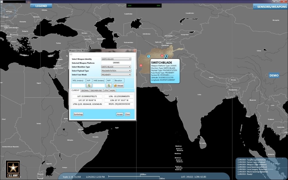
Display of a map with content focused around the map

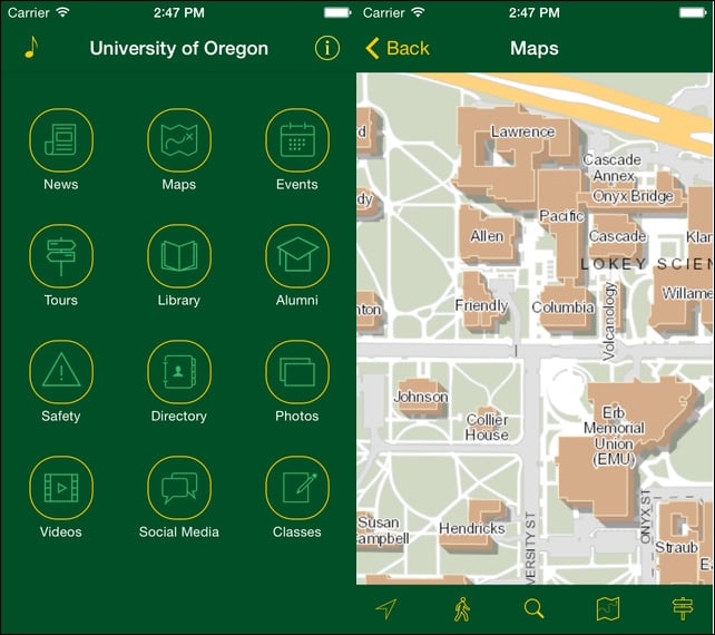
A non map-centric app will contain a map, but it isn't the central focus of the app. The map simply supplements the primary purpose of the map. Refer to the University of Oregon app, where Maps is just one of many parts of a larger app. Finally, there are apps where you don't see a map at all, but it might use geocoding and/or routing in the background and just return a coordinate or directions in the form of a list:

Now, there are new types of map displays, such as the Pufferfish, which is a globe that renders a map on its spherical display, as shown here:

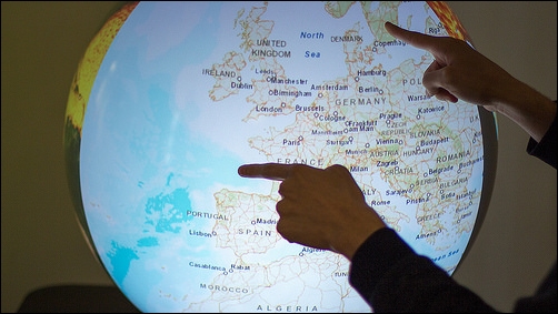
Map with a spherical display