Book Image

Learning ArcGIS Runtime SDK for .NET

By : Ron Vincent
Book Image

Learning ArcGIS Runtime SDK for .NET

By: Ron Vincent

Overview of this book

ArcGIS is a geographic information system (GIS) that enables you to work with maps and geographic information. It can be used to create and utilize maps, compile geographic data, analyze mapped information, share and discover geographic information and manage geographic information in a database. This book starts by showing you where ArcGIS Runtime fits within Esri’s overall platform strategy. You'll create an initial map using the SDK, then use it to get an understanding of the MVVM model. You'll find out about the different kinds of layers and start adding layers, and you'll learn to transform maps into a 3D scene. The next chapters will help you comprehend and extract information contained in the maps using co-ordinates and layer objects. Towards the end, you will learn to set the symbology, decide whether to use 2D or 3D, see how to implement 2D or 3D, and learn to search and find objects. You'll also get to grips with many other standard features of the Application Programming Interface (API), including create applications and finally testing, licensing, and deploying them. Once completed, you will be able to meet most of the common requirements of any mapping application for desktop or mobile platforms.
Table of Contents (19 chapters)
Learning ArcGIS Runtime SDK for .NET
Credits
About the Author
About the Reviewers
www.PacktPub.com
Preface
3
Maps and Layers
12
Configuring, Licensing, and Deploying
Index

Introducing geoprocessing


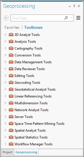
If you open up the Geoprocessing toolbox in ArcGIS Desktop or Pro, you will find dozens of tools categorized in the following manner:

With these tools, you can build sophisticated models by using ModelBuilder or Python, and then publish them to ArcGIS Server. For example, to perform a buffer, as we did in Chapter 5, Geometry and Symbology, with the GeometryEngine tool, you would drag the Buffer tool onto the ModelBuilder canvas, as shown here, and specify its inputs and outputs:

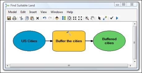
Drag tools on the canvas

This model specifies an input (US cities), performs an operation (Buffer the cities), and then produces an output (Buffered cities). Conceptually, this is programming, except that the algorithm is built graphically instead of with code. You may be asking: Why would you use this tool in ArcGIS Desktop or Pro? Good question. Well, ArcGIS Runtime only comes with a few selected tools in GeometryEngine. These tools, such as the buffer method in GeometryEngine, are so common...