-
Book Overview & Buying

-
Table Of Contents

Mastering QGIS
By :

Mastering QGIS
By:
Overview of this book
 Free Chapter
 Sign In
Start Free Trial

 Free Chapter
QGIS provides tools to convert between raster and vector data models. In this section, we will convert between the two data models using a national land cover dataset of 2006 for the Dallas area in Texas.
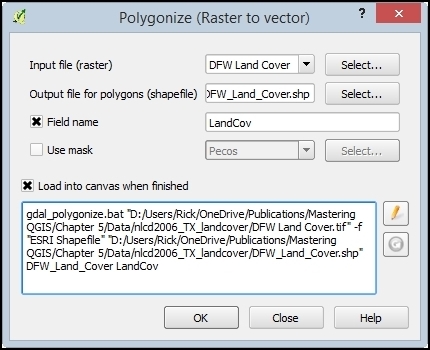
To convert a raster to a vector format, QGIS provides the Polygonize tool. The Polygonize tool converts an input raster file into any supported type of vector file and writes the raster cell values to a field in the vector file. When the raster is polygonized, adjacent cells of the same value are aggregated to a single larger polygon.
To access the Polygonize tool, click on Polygonize (Raster to Vector) by navigating to Raster | Conversion. The Polygonize tool is shown in the following screenshot and uses the sample DFW Land Cover.tif file as input:

To convert a raster to a vector polygon, the following options are available:
Input file (raster): Input file to be polygonized.
Output file for polygons (shapefile...


Change the font size
Change margin width
Change background colour