Maps are a 2D representation of the relevant features of places. Which features are relevant will depend on the purpose of the map; a map for a zoo will show the entrances, thematic areas, gift store, and where each animal is. In this case, there is no need for the sizes and distances to be precise. In a geologic map, we will need accurate distances and representations of the rock units and geologic strata.
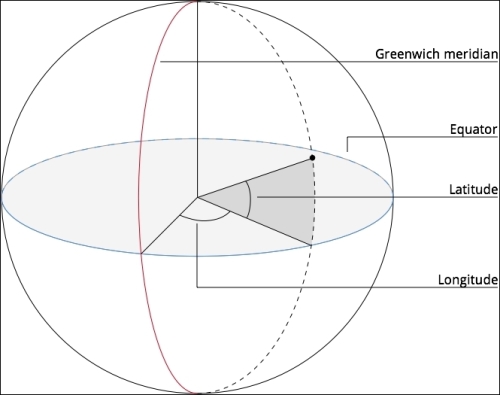
Positions on the surface of the earth are described by two coordinates, longitude and latitude. The longitude of a point is the angle between the point and the Greenwich meridian, and the latitude is the angle between the point and the equator. The latitude and longitude are the angles measured with respect to the equator and the Greenwich meridian, as shown in the following diagram:

The longitude can take values between -180 and 180, while the latitude can have values between 90 (the North Pole) and -90 (the South Pole).
Shapes on the earth can be described by...


