-
Book Overview & Buying
-
Table Of Contents

Learning QGIS, Third Edition - Third Edition
By :
Learning QGIS, Third Edition
By:
Overview of this book
QGIS is a user-friendly open source geographic information system (GIS) that runs on Linux, Unix, Mac OS X, and Windows. The popularity of open source geographic information systems and QGIS in particular has been growing rapidly over the last few years.
Learning QGIS Third Edition is a practical, hands-on guide updated for QGIS 2.14 that provides you with clear, step-by-step exercises to help you apply your GIS knowledge to QGIS. Through clear, practical exercises, this book will introduce you to working with QGIS quickly and painlessly.
This book takes you from installing and configuring QGIS to handling spatial data to creating great maps. You will learn how to load and visualize existing spatial
data and create data from scratch. You will get to know important plugins, perform common geoprocessing and spatial analysis tasks and automate them with Processing.
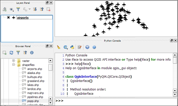
We will cover how to achieve great cartographic output and print maps. Finally, you will learn how to extend QGIS using Python and even create your own plugin.
Table of Contents (8 chapters)
Preface

 Free Chapter
1. Getting Started with QGIS
2. Viewing Spatial Data
3. Data Creation and Editing
4. Spatial Analysis
5. Creating Great Maps
6. Extending QGIS with Python
Index