Book Image

Python Geospatial Development - Third Edition

By : Erik Westra
Book Image

Python Geospatial Development - Third Edition

By: Erik Westra

Overview of this book

Geospatial development links your data to locations on the surface of the Earth. Writing geospatial programs involves tasks such as grouping data by location, storing and analyzing large amounts of spatial information, performing complex geospatial calculations, and drawing colorful interactive maps. In order to do this well, you’ll need appropriate tools and techniques, as well as a thorough understanding of geospatial concepts such as map projections, datums, and coordinate systems. This book provides an overview of the major geospatial concepts, data sources, and toolkits. It starts by showing you how to store and access spatial data using Python, how to perform a range of spatial calculations, and how to store spatial data in a database. Further on, the book teaches you how to build your own slippy map interface within a web application, and finishes with the detailed construction of a geospatial data editor using the GeoDjango framework. By the end of this book, you will be able to confidently use Python to write your own geospatial applications ranging from quick, one-off utilities to sophisticated web-based applications using maps and other geospatial data.
Table of Contents (20 chapters)
Python Geospatial Development Third Edition
Credits
About the Author
About the Reviewer
www.PacktPub.com
Preface
Index

Recommended best practices


In this section, we will look at a number of practical things you can do to ensure that your geospatial databases work as efficiently and effectively as possible.

Best practice: use the database to keep track of spatial references

As we've seen in earlier chapters, different sets of geospatial data use different coordinate systems, datums, and projections. Consider, for example, the following two geometry objects:

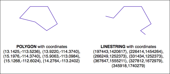
The geometries are represented as a series of coordinates, which are nothing more than numbers. By themselves, these numbers aren't particularly useful—you need to position these coordinates onto the earth's surface by identifying the spatial reference (coordinate system, datum, and projection) used by the geometry. In this case, the Polygon is using unprojected lat/long coordinates in the WGS84 datum, while the LineString is using coordinates defined in meters using the UTM zone 12N projection. Once you know the spatial reference, you can place the two...