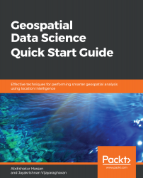
Geospatial Data Science Quick Start Guide is all about providing a segue for data scientists into mapping technologies, and for GIS scientific researchers into data science and machine learning techniques. Geospatial data science is the core technology used at companies including Uber, Google Maps, Apple Maps, Foursquare, and by real estate search apps such as realtor.com. An integral reason for the enormous success of these companies can be traced to their early successes in effectively identifying and leveraging the power of location data in the context of data science. Location data is a pervasive component of data repositories of any company in Silicon Valley, and the actual benefits of this data are yet to tapped due to a lack of expertise in this area. Geospatial Data Science Quick Start Guide will try to bridge this gap by equipping the reader with important skills for handling location data and effectively synergizing location data with machine learning techniques.

Geospatial Data Science Quick Start Guide
By :
Geospatial Data Science Quick Start Guide
By:
Overview of this book
Data scientists, who have access to vast data streams, are a bit myopic when it comes to intrinsic and extrinsic location-based data and are missing out on the intelligence it can provide to their models. This book demonstrates effective techniques for using the power of data science and geospatial intelligence to build effective, intelligent data models that make use of location-based data to give useful predictions and analyses.
This book begins with a quick overview of the fundamentals of location-based data and how techniques such as Exploratory Data Analysis can be applied to it. We then delve into spatial operations such as computing distances, areas, extents, centroids, buffer polygons, intersecting geometries, geocoding, and more, which adds additional context to location data. Moving ahead, you will learn how to quickly build and deploy a geo-fencing system using Python. Lastly, you will learn how to leverage geospatial analysis techniques in popular recommendation systems such as collaborative filtering and location-based recommendations, and more.
By the end of the book, you will be a rockstar when it comes to performing geospatial analysis with ease.
Table of Contents (9 chapters)
Preface
 Free Chapter
Introducing Location Intelligence
Consuming Location Data Like a Data Scientist
Performing Spatial Operations Like a Pro
Making Sense of Humongous Location Datasets
Nudging Check-Ins with Geofences
Let's Build a Routing Engine
Getting Location Recommender Systems
Other Books You May Enjoy
Customer Reviews

