Book Image

QGIS Quick Start Guide

By : Andrew Cutts
Book Image

QGIS Quick Start Guide

By: Andrew Cutts

Overview of this book

QGIS is a user friendly, open source geographic information system (GIS). The popularity of open source GIS and QGIS, in particular, has been growing rapidly over the last few years. This book is designed to help beginners learn about all the tools required to use QGIS 3.4. This book will provide you with clear, step-by-step instructions to help you apply your GIS knowledge to QGIS. You begin with an overview of QGIS 3.4 and its installation. You will learn how to load existing spatial data and create vector data from scratch. You will then be creating styles and labels for maps. The final two chapters demonstrate the Processing toolbox and include a brief investigation on how to extend QGIS. Throughout this book, we will be using the GeoPackage format, and we will also discuss how QGIS can support many different types of data. Finally, you will learn where to get help and how to become engaged with the GIS community.
Table of Contents (9 chapters)

Making a map in QGIS

Click on Project | New Print Layout (or click the corresponding button on Project Toolbar).

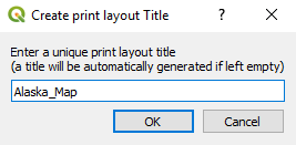
In the Create print layout Title dialog box (shown as follows), give your new, empty map a title and click OK:

Creating a new print layout

You will now have an empty canvas on which we will build our map. Add your map to the layout canvas via the menu by going to Add Item | Add Map. Then, click and drag the mouse to draw on the canvas in the location you want to put your map. This will add an Item called Map 1; we will add more items later. This is shown in the following screenshot:
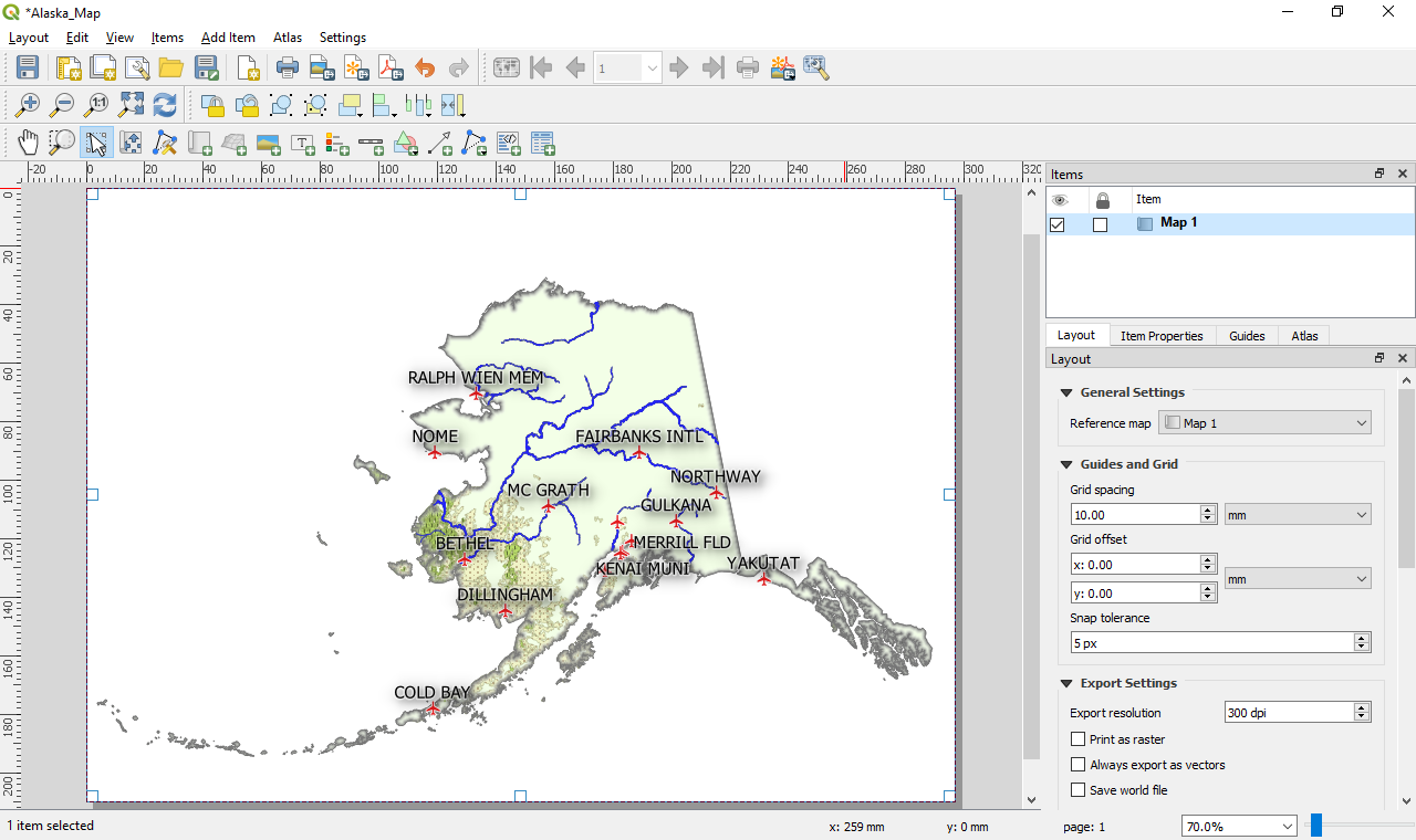
Map layout
Please note that for ease of reading this book, the label size has been increased.
For this reason you will find that the screen shots are slightly different to your screen.

With Map 1 selected, click on the Item Properties tab and set the scale to 12000000, as this will display...