Book Image

QGIS Quick Start Guide

By : Andrew Cutts
Book Image

QGIS Quick Start Guide

By: Andrew Cutts

Overview of this book

QGIS is a user friendly, open source geographic information system (GIS). The popularity of open source GIS and QGIS, in particular, has been growing rapidly over the last few years. This book is designed to help beginners learn about all the tools required to use QGIS 3.4. This book will provide you with clear, step-by-step instructions to help you apply your GIS knowledge to QGIS. You begin with an overview of QGIS 3.4 and its installation. You will learn how to load existing spatial data and create vector data from scratch. You will then be creating styles and labels for maps. The final two chapters demonstrate the Processing toolbox and include a brief investigation on how to extend QGIS. Throughout this book, we will be using the GeoPackage format, and we will also discuss how QGIS can support many different types of data. Finally, you will learn where to get help and how to become engaged with the GIS community.
Table of Contents (9 chapters)

Saving styles

Styling data to be presented in a map can take significant time and you may wish to reuse and/or adapt your created styles in the future. This can be done by saving your style as a style file. To do this, right-click on a layer and select Properties.

In the lower-left corner of the Layer Properties dialog box is a button called Style, shown in the following screenshot:

Saving a style

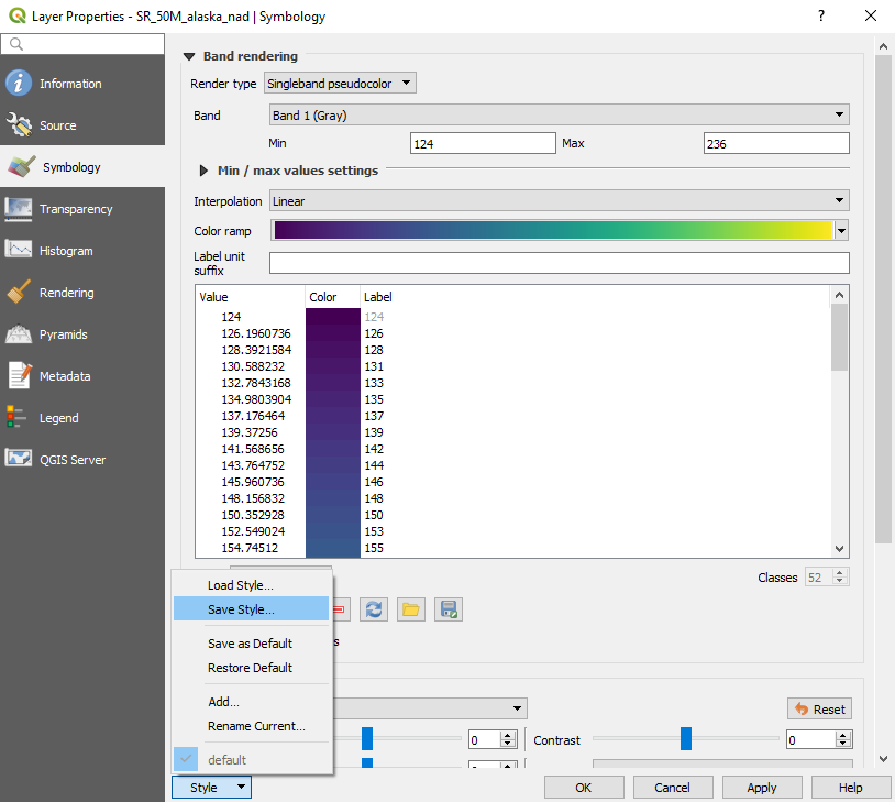
Select Save Style. There are three options for saving a style. You can save the .qml file to your project directory, you can save the style as an SLD (Styled Layer Descriptor file commonly used to style raster data online, in GeoServer for example), or you can save it directly into a GeoPackage. In this case, I have chosen to save it as a .qml file, with all the categories turned on, in my project directory. Click on OK to close the Layer Properties dialog box. Right-click on...