

The openstreetmap.org website has a built-in map export function that you can use to produce images in various formats, at any scale using either of the example renderings on the site. The exporter doesn't allow you to change the style of the map.
To use the exporter, click on the Export tab at the top of the slippy map. A sidebar will appear to the left of the slippy map showing the exporter controls:
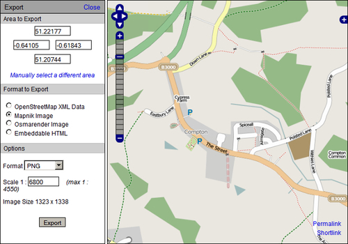
The default area to export is the whole of the map view. You can change this area by changing the map view itself, which should be reflected in the coordinates shown at the top of the sidebar. Alternatively, you can click Manually select a different area and drag a rectangle over the area you'd like a map of. Finally, you can enter the coordinates of the area you want to map directly into the form, and a rectangle will be drawn on the map to show the area you've specified.
If you need to save the location of an area you're exporting, you can use the Permalink in...