

Although it's more related to programming than web mapping, it's recommended to increase your abilities at using web debuggers.
Chrome DevTools by default offers the main functions to develop and debug with OpenLayers, but to be more efficient, it's really required to use extensions. Extensions are additions to Chrome browser or to the Developer Tools to add or augment default software functions. You can find most of them at http://www.google.com/intl/en/chrome/webstore/extensions.html.
We'll review some of them.
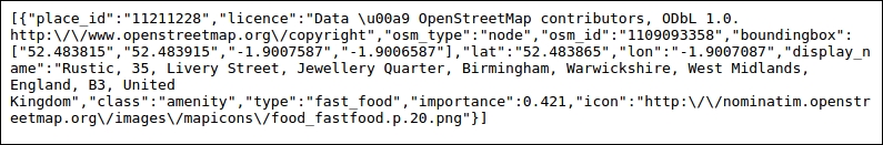
Usually you're consuming web services providing JSON (JavaScript Object Notation) when you're doing mashups. To illustrate why the add-on is useful, we will use a geocoder service, such as Nominatim, to retrieve position for a postal code. A geocoder is a tool to match addresses with geographic coordinates.
For example, typing http://nominatim.openstreetmap.org/search?q=35+Livery+Street+Birmingham&format=json&limit=1 in Chrome will send you the following screenshot:
With the extension, you will directly get an indented content, collapsible.
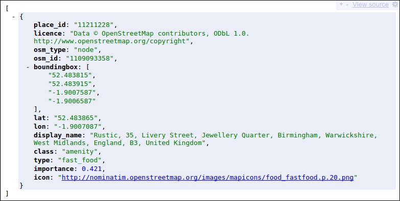
So what is the difference? When it's required to correctly reuse data, we must understand received data and with this plugin, the return content is human readable! Furthermore, OpenLayers can consume GeoJSON, a subset JSON notation dedicated to maps data.
Download it at https://chrome.google.com/webstore/detail/jsonview/chklaanhfefbnpoihckbnefhakgolnmc.
When you are making a custom UI, you always have to try different colors.
You can also retrieve a color you like from another website or an image. In this situation, you will not want to always go back and forth between a graphic tool such as Gimp or Photoshop and your browser. So in this case, you can install ColorZilla. How is this related to OpenLayers? When you want to make customize controls elements, this is an invaluable tool. Go to http://www.colorzilla.com/chrome/ to retrieve it. It's also a plugin available for Firefox.
Tip
If you really want to improve your skills for using Chrome Developer Tools, you should visit Code School tutorial at https://www.codeschool.com/courses/discover-devtools. Use also the videos available in the official documentation at https://developers.google.com/chrome-developer-tools/docs/videos.
Visit the Secrets of the Browser Developer Tools website, http://devtoolsecrets.com. It covers all browsers!